Short Article
17:10:19
LiDAR Technique
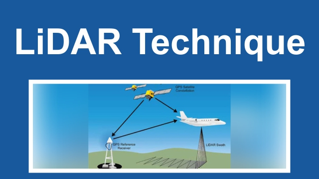
The Indian Railways shall use the LiDAR technique to perform a ground survey of the Delhi Varanasi High Speed Rail Corridor. LiDAR is the Light Detection and Ranging technique.
About LiDAR:
-
It is a remote sensing system that uses light in the form of a pulsed laser to determine the distances available in the world. The light bursts in the device produce three-dimensional knowledge on the shape of the earth and its surface characteristics.
-
The LiDAR system consists of a scanner, a laser and a GPS receiver. Helicopters and aeroplanes are the most widely used vehicles for the acquisition of LiDAR data.
-
There are two types of LiDAR, Topographic and Bathymetric. The topographic LiDAR uses infrared lasers to map the land. On the other hand, the bathymetric LiDAR uses water penetrating green light and measures river bed elevations and sea floors.